
Nuestra misión
La división WPCOG GIS/Data Services es un recurso central de información geográfica para la región de Western Piedmont. El WPCOG proporciona una variedad de soluciones de mapeo digital, servicios de datos geoespaciales y datos demográficos para los gobiernos miembros y otras agencias públicas y privadas. La división GIS/Data Services mantiene una extensa biblioteca de conjuntos de datos locales, del condado, regionales y estatales para respaldar numerosos proyectos de WPCOG.

Data Mapping
GNSS Data Collection
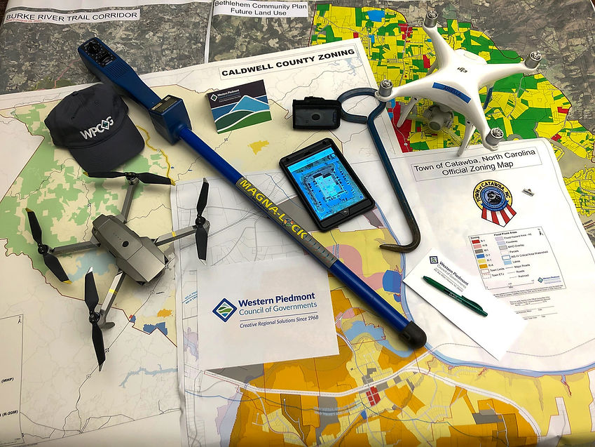
WPCOG staff can visit the field and map desired features to an accuracy of 0.5 meter (note: not survey grade, contact GIS services for details). GIS workers use georeferenced as-builts, orthophotography and up-to-date Trimble GNSS receivers that gather positional data from multiple satellite constellations, including GPS, GLONASS, Galileo and Beidou constellations.
Utility Mapping
It is not uncommon that local utilities still rely on crumbling paper maps, hand-drawn notes or worker recollection to know where crucial assets are located. Using satellite-based receivers, WPCOG staff can map features to an accuracy of 0.5 meter (20 inches) (note: not survey grade, contact GIS services for details). The personnel have extensive experience in mapping features of water, sewer, stormwater and electric systems on the municipal level.
GIS Data Creation & Maintenance
WPCOG staff can create GIS data from a variety of sources, including lists of addresses, paper maps or field-collected data. The GIS information can be hosted on WPCOG's servers and be maintained and updated by GIS employees.
Database Design & Maintenance
WPCOG staff can customize the information collected about types of features (such as water meters or manholes) to fit the needs of an agency. Spatial location and attributes of each feature can be accessed quickly and uniformly across all records.
Geocoding
WPCOG staff can transform text-only data, such as a list of billing addresses, into spatial locations within a GIS. This allows these locations to be used in conjunction with other spatial data.
Large Format Printing/Scanning
WPCOG GIS Services has a large format scanner which can be used on documents up to 36 inches wide. It scans up to 600 dpi in both color and grayscale. The following output file formats are supported: JPEG (.jpg), PDF (.pdf), and TIFF (.tif). GIS Services can also print images/maps up to 36 inches wide.
Data Analysis
Census & Demographic Analysis
WPCOG staff can study changes in the composition of the population to plan for growth in education, health care services and economic development projects. GIS staff members have extensive experience in accessing and analyzing data from the US Census, NC State Data Center and many other sources in order to assist elected officials and government staff to make better planning decisions.
Landuse and Zoning Mapping
WPCOG staff can access and use landuse, zoning and other spatial datasets to analyze any given areas to determine suitability for a desired purpose.
Environmental Applications
WPCOG staff can use statewide infrared, orthophotography or other sources to determine coverages for a given area. For example, GIS staff can analyze state data to determine the amount of water-impermeable surface area within a municipality's limits.
Data Applications
Census & Demographic Analysis
WPCOG staff can study changes in the composition of the population to plan for growth in education, health care services and economic development projects. GIS staff members have extensive experience in accessing and analyzing data from the US Census, NC State Data Center and many other sources in order to assist elected officials and government staff to make better planning decisions.
Landuse and Zoning Mapping
WPCOG staff can access and use landuse, zoning and other spatial datasets to analyze any given areas to determine suitability for a desired purpose.
Environmental Applications
WPCOG staff can use statewide infrared, orthophotography or other sources to determine coverages for a given area. For example, GIS staff can analyze state data to determine the amount of water-impermeable surface area within a municipality's limits.
Contracted Services
Staff can provide full GIS services to local governments in the Greater Hickory Metro. Staff can work onsite with other departments within a local government to convert and import non-digital forms of spatial data into the new GIS, and also collect municipal utility and other features with GPS units. Once created, the GIS can be maintained by WPCOG staff on an ongoing basis, or the local government can take over direct management of GIS data with its own personnel. These services are also available to government-related non-profit organizations within the region.